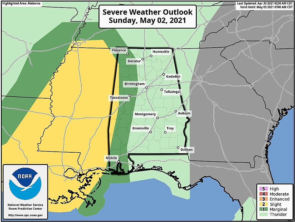
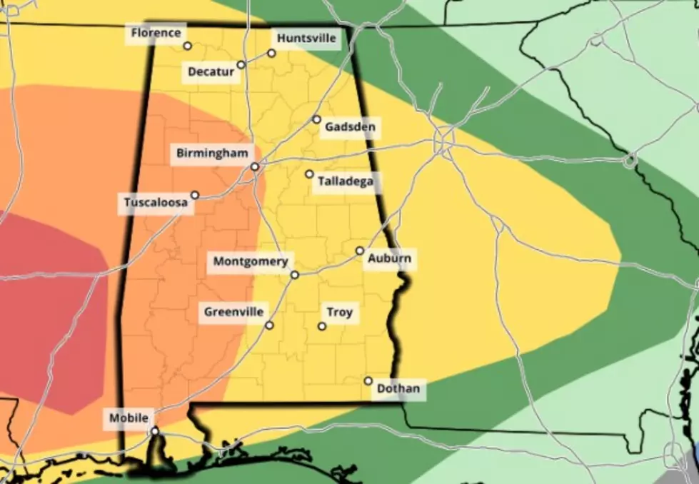
Severe Storms Likely in Alabama Today
Tornadoes, hail, and damaging winds are possible across West Alabama today as a cold front makes its way across the state. Severe storms are possible ahead of the cold front, and the National Weather Service in Birmingham has placed the western 2/3 of the state under a limited risk area today; threats in this area include tornadoes, damaging winds of up to 60 MPH, and quarter size hail.
Storms are expected to impact West Alabama as early as noon today; the core threat for our area will occur between 4 p.m. and 7 p.m. Storms will start to impact Central Alabama around 2 p.m.
More From Alt 101.7